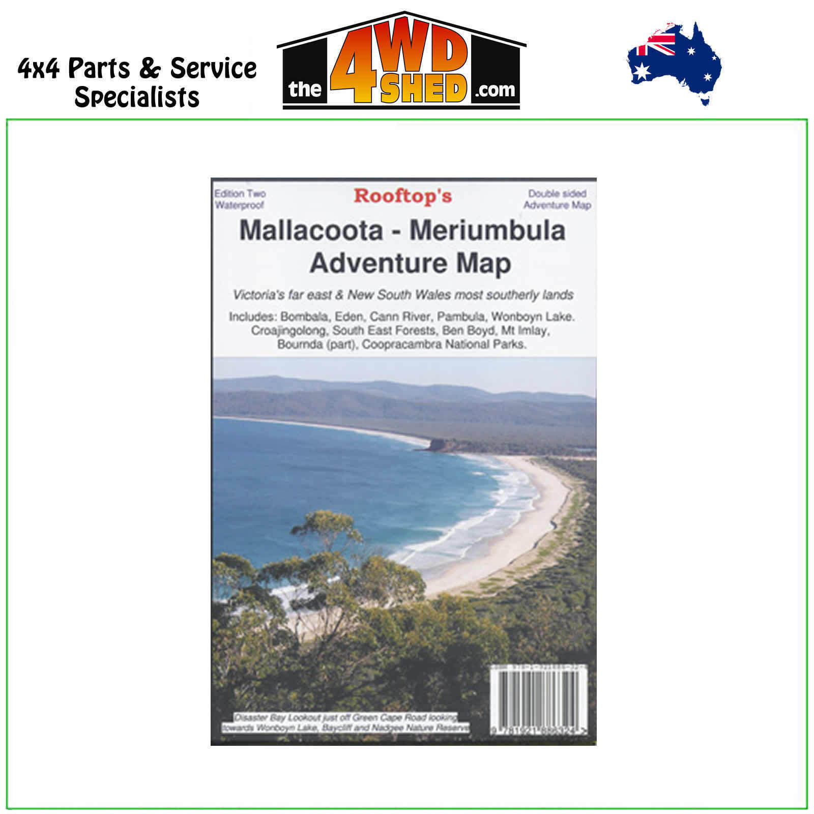

Mallacoota Merimbula Rooftop Adventure Map

 More info
Mallacoota Merimbula Rooftop Adventure Map
2nd Edition 2022 - Waterproof
Topographical Maps are used for Walking, 4WD, Fishing, Camping, Motorcycle, both On and Off Road, Gold Prospecting and for those simply going for a family weekend drive.
Though moving into an age of GPS & digital maps, paper maps provide a great back up & being more accessible for a group to plot a day out on the tracks.
Australia’s Far South East Corner
Includes: Bombala, Eden, Merimbula, Cann River, Wolumla, Wyndham, Wonboyn Lake, Ben Boyd NP, Croajingolong NP, South-East Forests NP, Mount Imlay, Coopracambra NP, Alfred NP, Tamboon Inlet, Wingan Inlet, Mallacoota Inlet, Gabo Island etc.
Information includes walking tracks, vehicle tracks, roads, estuaries, watercourses, places of interest, navigation markers, boat ramps, jetties etc.
Insets of Gabo Island and Mallacoota Inlet.
Scale Main Map: 1:100,000
Please Note: These maps are provided as a guide only. You are responsible for being aware of track closures, changes to track accessibility & access guides. Please visit the Parks Victoria website to check before planning your next journey.
(705105678436W)
| SKU | 705105678436W |
| Barcode # | 689076913669 |
| Brand | Rooftops |
| Shipping Weight | 0.1000kg |


