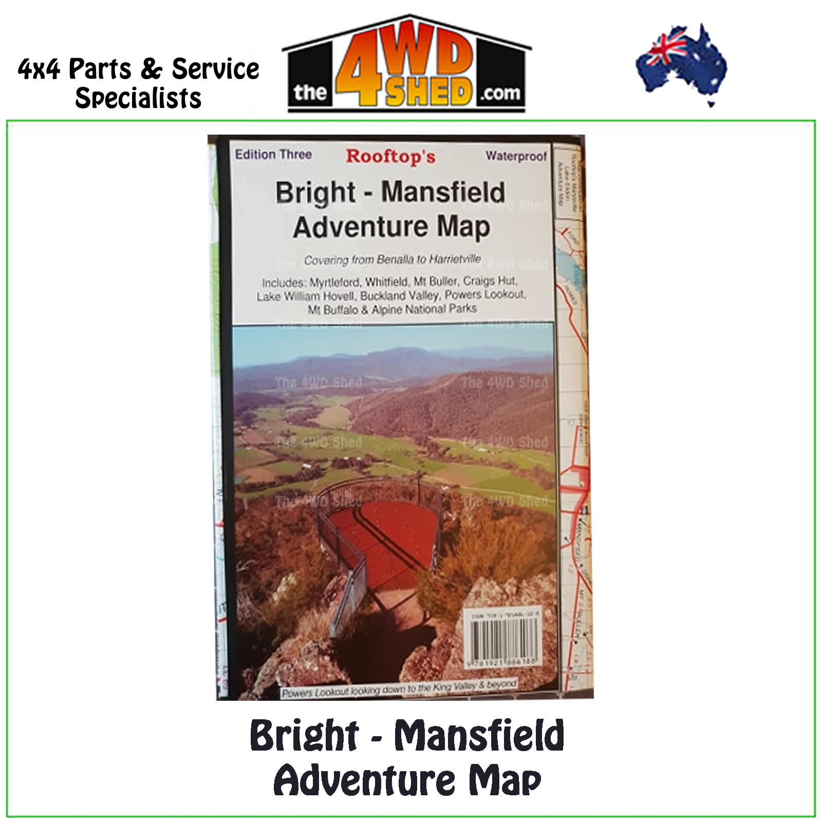

Bright Mansfield Adventure Map 1:100 000

 More info
Bright Mansfield Adventure Map 1:100 000 *Waterproof
Third Edition 2016 Waterproof
The reverse of the map has a 1:50 000 scale enlargement titled Bright - Whitfield Forest Activities Map featuring Mount Buffalo National Park.
Topographical Maps are used for Walking, 4WD, Fishing, Camping, Motorcycle, both On and Off Road, Gold Prospecting and for those simply going for a family weekend drive.
Though moving into an age of GPS & digital maps, paper maps provide a great back up & being more accessible for a group to plot a day out on the tracks.
Map Coverage is from Myrtleford, Bright, Moyhu & Benalla in the north to Mansfield, Mount Buller & Wonnangatta Station in the south. It includes Whitfield, Harrietville, Buckland, Buffalo River, Mount Buffalo, Powers Lookout, Cheshunt & part of the Alpine National Park.
Scale is 1:100 000 with contours, points of interest, photos etc
- Scale: 1:100 000 main map
- Scale : 1:50 000 reverse map
- Printed both sides
- Waterproof Paper
- Suitable for use with GPS
- Extensive 4wd tracks coverage
- Ideal for camping, touring, motorbiking, 4WD & boating
- Walking tracks and campsites
- Colour with contours & notes
Please Note: These maps are provided as a guide only. You are responsible for being aware of track closures, changes to track accessibility & access guides. Please visit the Parks Victoria website to check before planning your next journey.
ISN : 978-1-921886-18-8
(9781921886188)
| SKU | 9781921886188 |
| Barcode # | 9781921886188 |
| Brand | Rooftops |
| Shipping Weight | 0.1000kg |


