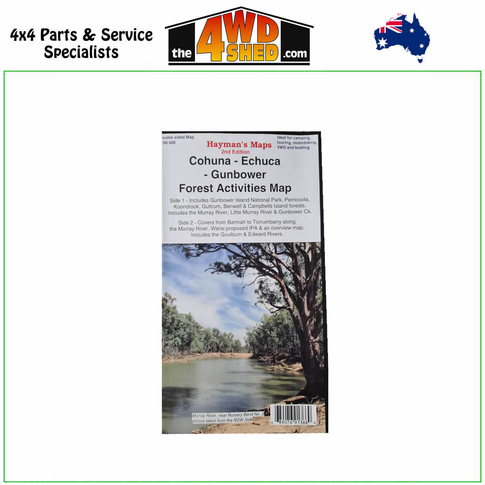
Cohuna - Echuca - Gunbower Forest Activities Map

 More info
Cohuna Map and Echuca Gunbower Forest Activities Map
2nd Edition - October 2014
Hayman's Maps have developed a range of regional maps which specialise in tourist, adventure and 4wd maps. Their maps are widely recognized for their attention to detail, accuracy, attractive presentation and clarity. The maps cater for the serious explorer, tourist, 4wd enthusiast, bushwalker or anyone who simply wants to get away from it all and explore different places. Whether its along a main highway or off the beaten track Hayman's Maps are the ideal choice.
Do you want to explore the lesser frequented hidden gems of our natural areas? Then Hayman's Maps are an ideal starting point.
- Scale: 1:50 000 main map
- Scale: 1:75 000 inset map
- Updated: 2014
- Double sided with overlapping panel
- Suitable for use with GPS
- Extensive 4wd tracks coverage
- Ideal for camping, touring, motorbiking, 4WD & boating
- Walking tracks and campsites
- Map Size: 100cm x 70cm approx
- Colour with contours, photographs & notes
The map is a large double sided map with photographs & notes.
Side 1 is a 1: 50 000 map covering the region bounded by Torrumbarry Weir in the south and Murrabit in the north. The Gunbower National Park and State Forest and Perricoota and Koondrook forests are covered in detail.
Side 2 contains several maps. The main map is a 1:50 000 map covering from Barmah to Torrumbarry, there is a 1: 75 000 map of Werai State Forest to the NW of Deniliquin and an overview map (1:350 000) showing how the maps link together and access routes to the areas.
Maps are colour large (approx. 100cm x 70cm), doubled sided with photos and text. All maps come folded and are easy to read and use.
The maps are produced primarily at 1:50 000 or 1:100 000 scale have large text and are easy to read and navigate with. Some maps and insets of areas are produced at larger scales. Some maps are topographical depending on the topography of the region.
Please Note: These maps are provided as a guide only. You are responsible for being aware of track closures, changes to track accessibility & access guides. Please visit the Parks Victoria website to check before planning your next journey.
(689076913669)
| SKU | 689076913669 |
| Barcode # | 689076913669 |
| Brand | Haymans Maps |
| Shipping Weight | 0.1000kg |


