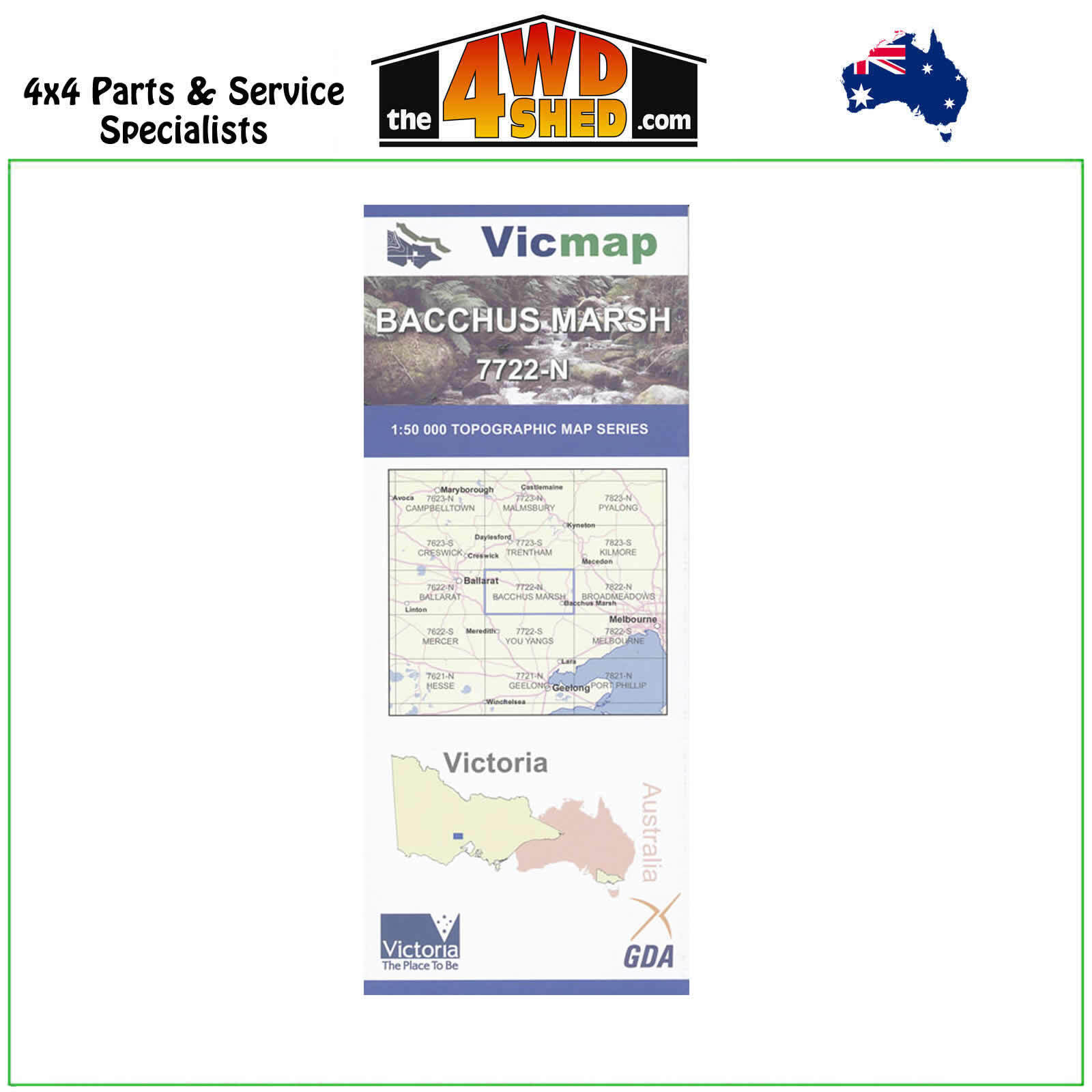
Bacchus Marsh VicMap 1:50 000 Topographic Map Series 7722-N

 More info
Bacchus Marsh 7722-N Topographical Map 1:50 000
Topographical Maps are used for Walking, 4WD, Fishing, Camping, Motorcycle, both On and Off Road, Gold Prospecting and for those simply going for a family weekend drive.
Though moving into an age of GPS & digital maps, paper maps provide a great back up & being more accessible for a group to plot a day out on the tracks.
This is 1:50 000 scale map, with enlargements of specific areas..
Topographical maps show not only contours of the terrain but walking tracks, sealed and unsealed roads, rivers, creeks, lakes, historical points of interest, old mine sites and National & State Park areas.
Map Features:
Part of the Wombat SF, Korobeit, Myrniong, Greendale, Craig Hill, German Track, Coimadai, Green Hills, Whisky Gully, Nolan Gully, Lerderderg Gorge, Bluegum Hogan Link Track, mbtg, Scotties Gully Track, Mount Bullengarook, Cataract Creek, Cataract Falls, Middle Gully, Watties Track, Spanish Onion Track, The East Walk, Vodka Track, Rum Track, Upsall Hill, part of the Great Dividing Track, Golden Creek Falls, Champagne Track, mbtg, Dales Creek, part of Wombat SF, Garibaldi Hill, Lowes Hill, Square Bottle Track, Strachan Hill, Pyrete Range Reference Area, West Number 2 Track, Mount Blackwood Fire Lookout, Greendale Hill, mbtg, Korweinguboora Creek, Pykes Hill, Ah Kows Gully Reference Area, Grassy Gully Track, Lerderderg River, Bears Head Range, Long Point, West Number 5 Track, Lerderderg Four Wheel Drive Training Area, Blackwood Range, Korjamnunnip Creek, Mount Gorong, mbtg, Ballan, Pykes Creek Reservoir, Myrniong Creek, Link Number 1 Track, Grahams Dam, Merrimu Reservoir, Werribee River. mbtg, Bacchus Marsh, Merrimu, Glenmore, Part of Brisbane Ranges NP, Part of the great Dividing Range, Pentland Hills, Darley, part of Lerderderg SP, Goodman Creek, Merrimu Reservoir, Merrimu Track, Parwan Creek, Mount Darriwill, mbtg, Lake Dewar Lodge YMCA, Korjamnunnip Creek, Long Forest FFR, Sunnystones Country Retreat, Lerderderg River, The Island Lookout, Werribee Gorge SP, Parwan Falls, mbtg, Ingliston Gorge, Ingliston Track, Upper Sloss Gully Cascades, Ironbark Gorge Track, Western Bluff Lookout, Gorrocburkghap Falls, Blackwood Pool, Falcons Lookout, mbtg, Hopetoun Park, Pyrites Creek, Anthonys Cutting, Pyrites, Gorrock, Yaloak Vale, Melton Reservoir, Rowsley, Spring Creek
Lal Lal, Bungal, Yaloak, Fisken Hill, Granite Creek, Yendon Blue Bridge, Lower Moorabool Falls, Mount Egerton, Bungal SF, Green Hill Gully, British Empire Mine, Mount Hydewell, mbtg, Yaloak Creek, Blair Creek, Lal Lal Reservoir, Lal Lal Falls SR, Moorabool Falls, Lal Lal Falls Lookout, ECC Mine House, Lal Lal Bungal HA, Historic Furnace, mbtg, Ryan Hill, Bungal Plantation, Fiskville, Yaloak Falls, Paddock Track, Hunts Bridge, Champion Hill, Mount Doran, Murray Bridge, Borhoneyghurk Common, Ballark Track, Mount Wallace, mbtg, edge of Brisbane Ranges, Lal Lal Seed Orchard Plantation, part of The Great Dividing Range, mbtg, Ballan, Mount Steiglitz, Bald Hill, Bungaree, Wallace, McDonald Reservoir, Gordon, Millbrook, Mount Edgerton, Bostock Reservoir, Cleever Hill
Please Note: These maps are provided as a guide only. You are responsible for being aware of track closures, changes to track accessibility & access guides. Please visit the Parks Victoria website to check before planning your next journey.
(7722-N)
| SKU | 7722-N |
| Model # | 7723-7823 |
| Barcode # | 9781742870267 |
| Brand | Vicmap |
| Shipping Weight | 0.1000kg |


