Categories
- 4WD Caravan and Camping Equipment
- Awnings and Accessories
- Camping Furniture
- Caravan Pads, Ramps and Chocks
- Cargo Management
- Cooking Equipment
- Dog & Gun Coffee
- Electric Brake Controllers
- Fire Extinguisher and Blankets
- First Aid
- Fridges and Accessories
- Jerry Cans
- Lighting and Accessories
- Portable Steps & Accessories
- Power Management
- Solar
- Storage
- Tools
- Topographic Maps
- Towing and Accessories
- Trailer Lights and Wiring
- Trailer Loading Ramps
- Tyre Equipment
- UHF Radio and Accessories
- Vehicle Jacks
- 4WD Recovery Equipment
- Air Compressors
-
Front Recovery Tow Points
- Ford Ranger
- GWM
- Holden Colorado
- Isuzu DMAX
- Mazda BT50
- Mitsubishi Pajero
- Mitsubishi Triton
- Nissan Navara
- Nissan Patrol
- Suzuki
- Toyota 100 Series Landcruiser
- Toyota 120 Series Prado
- Toyota 150 Series Prado
- Toyota 200 Series Landcruiser
- Toyota 250 Series Prado
- Toyota 300 Series Landcruiser
- Toyota 70 Series Landcruiser
- Toyota 80 Series Landcruiser
- Toyota FJ Cruiser
- Toyota Hilux
- Volkswagen Amarok
- Gloves
- GPS Trackers
- Kinetic Rope
- Rear Recovery Hitches
- Recovery Kits
- Recovery Straps
- Recovery Track Boards
- Rings, Shackles, Thimbles and Hooks
- Sand Flag
- Storage Bag
- Winch Cable Damper
- Winch Fairleads
- Winch Rope
- Winches Parts and Accessories
- Body and Trim
-
Battery Trays
- 100 Series Landcruiser
- 200 Series Landcruiser
- 300 Series Toyota Landcruiser
- 70 Series Landcruiser
- Battery Bracket Mounting Kits
- Ford Ranger
- Great Wall
- Holden Colorado
- Isuzu DMAX
- Jeep
- Mazda BT50
- Mitsubishi Pajero
- Mitsubishi Triton
- Nissan GU Patrol
- Nissan Navara
- Prado 120 Series
- Prado 150 Series
- Toyota Hilux
- Universal
- Volkswagen Amarok
- Bonnet Struts
- Tailgate Strut
- Grilles
- Snorkels
- Tailgate Rubber Seal Kit
- Interior
- Window Switch Control
- Under Body Protection
- 4WD Car Wash Products
- Badges
- Body Mount
- Bonnet Misc
- Bonnet Protector
-
Bumper and Bull Bars
- Jungle 4x4 Full Loop Bull Bar
- Jungle 4x4 No Loop Bull Bar
- Oxley 4x4
- PIAK Elite Loop Winch Bull Bar
- PIAK Elite Non Loop Winch Bull Bar
- PIAK Genesis Loop Bullbar
- PIAK Genesis Non Loop Bullbar
- PIAK Nudge Bar
- RAXAR Looped Bull Bar
- RAXAR No Loop Bull Bar
- Rhino 4x4 Front Bar
- Rhino 4x4 Nudge Bar
- Rhino 4x4 Rear Bar
- Rival Bullbar
- Ultimate9 Nudge Bar
- Car Seat Covers
- Central Locking Kit
- Child Seat Anchor Kit
- Console Lid Cover
- Dash Mat
- Door Handles
- Door Sill Protector
- Door Step
- False Floor Systems
- Flare Kits
-
Floor Mats
- BYD Shark
- Ford Everest
- Ford Ranger
- GWM Tank
- Holden Colorado
- Isuzu DMAX
- Isuzu MUX
- JAC T9
- Jeep Gladiator
- Jeep Wrangler
- KIA Tasman
- Land Rover
- LDV
- Mazda BT50
- Mitsubishi Pajero
- Mitsubishi Triton ML MN
- Mitsubishi Triton MQ MR
- Mitsubishi Triton MV
- Nissan Navara NP300
- Nissan Patrol GQ
- Nissan Patrol GU
- Nissan Patrol Y62
- Suzuki Jimny
- Toyota Fortuner
- Toyota Hilux
- Toyota Landcruiser 100 Series
- Toyota Landcruiser 200 Series
- Toyota Landcruiser 300 Series
- Toyota Landcruiser 76 Series
- Toyota Landcruiser 79 Series
- Toyota Landcruiser 80 Series
- Toyota Prado
- Universal
- Volkswagen Amarok
- Gear Stick Extension
- Headlight Surround
- Huracan Fabrication Premium Touring Seats
- Mirrors
- Mudflaps
- Pedals
- Rear Bumper Bar
- Rear Spare Wheel Accessories
- Rear Sports Bar
- Recovery Tow Points
- Rock Sliders
- Roller Shutter
- Roof Rack
- Rubber Wheel Arch Flares
- Seat Adaptor Kit
- Seat Protector
- Side Scrub Rails
- Side Steps
- Tailgate Storage Kit
- Terrain Tamer Suspension Seats
- Tow Bar Accessories
- Towbar
- Weather Shields
- Windscreen Washer Bottle
- Windscreen Wiper Blade
-
Battery Trays
- Lighting
- Power and Performance Upgrade
- Flashlube Diesel Filter Kits
- High Flow Air Box
- Hulk 4x4 Electronic Throttle Controller
- Lubricants, Fluids, Oils, Additives & Conditioners
-
Manta Exhaust System Kit
- 100 Series Toyota Landcruiser 4.2L 1HD
- 100 Series Toyota Landcruiser 4.7L V8
- 105 Series Toyota Landcruiser 4.2l 1HZ
- 105 Series Toyota Landcruiser 4.5l 1FZ
- 150 Series Toyota Prado GDJ150 2.8L
- 200 Series Toyota Landcruiser URJ202 4.6L V8
- 200 Series Toyota Landcruiser UZJ200 4.7L V8
- 200 Series Toyota Landcruiser VDJ200 V8
- 250 Series Toyota Prado 2.8l
- 300 Series Toyota Landcruiser V6
- 75 78 Series Toyota Landcruiser FZJ 4.5L 1FZ Petrol
- 75 78 Series Toyota Landcruiser HZJ 4.2L 1HZ Diesel
- 75 78 Series Toyota Landcruiser HZJ 4.2L Turbo Diesel with Aftermarket Turbo
- 75 Series Toyota Landcruiser FJ75 4.0L 3F Petrol
- 75 Series Toyota Landcruiser HJ75 4.0L 2H Diesel
- 76 Series Toyota Landcruiser VDJ76 4.5L 1VD V8 Turbo Diesel 2007-2016
- 76 Series Toyota Landcruiser VDJ76 4.5L 1VD V8 Turbo Diesel Wagon 2016-On
- 78 Series Landcruiser HDJ78 4.2L Turbo Diesel Troop Carrier
- 78 Series Toyota Landcruiser VDJ 4.5L 1VD V8 Turbo Diesel Troop Carrier 2007-2016
- 78 Series Toyota Landcruiser VDJ 4.5L 1VD V8 Turbo Diesel Troop Carrier 2016-On
- 79 Series Landcruiser FZJ79 4.5L 6cyl Petrol
- 79 Series Toyota Landcruiser GDJ79 Single & Dual Cab 2.8L Turbo Diesel 2023-On
- 79 Series Toyota Landcruiser HDJ79 4.2L 1HD Turbo Diesel
- 79 Series Toyota Landcruiser HZJ 4.2L 1HZ 6cyl Diesel with Aftermarket Turbo
- 79 Series Toyota Landcruiser HZJ79 4.2L 1HZ Diesel
- 79 Series Toyota Landcruiser Superior Outback Systems
- 79 Series Toyota Landcruiser VDJ Dual Cab 4.5L 1VD V8 Turbo Diesel 2012-2016
- 79 Series Toyota Landcruiser VDJ Single & Dual Cab 4.5L 1VD V8 Turbo Diesel 2016-2024
- 79 Series Toyota Landcruiser VDJ Single Cab 4.5L V8 Turbo Diesel 2007-2016
- 80 Series Toyota Landcruiser 4.2L 1HD
- 80 Series Toyota Landcruiser 4.2L 1HZ
- 80 Series Toyota Landcruiser 4.5L 1FZ
- Ford Everest Next Gen T6.2 V6 3.0l
- Ford Ranger Next Gen Raptor V6
- Ford Ranger Next Gen T6.2 4cyl 2.0L BI-TURBO DPF
- Ford Ranger Next Gen T6.2 V6 3.0L DPF
- Ford Ranger PX 2011-2016 2.2L
- Ford Ranger PX Dual Cab 3.2L CRD NON-DPF
- Ford Ranger PX2 PX3 Dual Cab 3.2L CRD DPF
- Great Wall Motors GWM Cannon Ute
- Holden Colorado RG 2012- 2016 2.8L Non-DPF
- Holden Colorado RG 9/2016-On 2.8L
- Isuzu DMAX 3.0L CRD 2012-2017
- Isuzu DMAX 3.0L CRD 2021-On
- Isuzu MUX 3.0L CRD 2017-2021
- Mazda BT50 1.9L 2021-On
- Mazda BT50 2011-2016 2.2L
- Mazda BT50 3.0L CRD DPF 2020-On
- Mercedes X-Class 2.3L DPF
- Mitsubishi Triton MQ MR 2.4L CRD
- Nissan Navara D23 NP300 2.3L DPF 2015-On
- Nissan Patrol GQ
- Nissan Patrol GU 2.8L Turbo Diesel
- Nissan Patrol GU 4.2L NA Diesel
- Nissan Patrol GU 4.2L TD42 Turbo Diesel
- Nissan Patrol GU 4.5L TB45 Petrol
- Nissan Patrol GU 4.8L
- Nissan Patrol GU UTE 3.0L Turbo Diesel 2008-2017
- Nissan Patrol GU UTE 4.2L Turbo Diesel
- Nissan Patrol GU ZD30 3.0L Turbo Diesel 2000-2006
- Nissan Patrol GU ZD30 3.0L Turbo Diesel 2007-2017
- Nissan Patrol Y62 V8 5.6L
- OEM DPF Replacement Unit
- Suzuki Jimny 1.5L Petrol
- Toyota FJ Cruiser GSJ15R V6 4.0L
- Toyota Hilux N70 KUN 3.0L D4D
- Toyota Hilux N80 GUN126R 2.8L D4D
- Volkswagen Amarok TDI400 TDI420 2H 2.0l
- Volkswagen Amarok TDI550 TDI580 2H V6 3.0l
- Volkswagen Amarok TDI600 V6 Diesel
- Misc
- ProVent Ultimate Catch Can Kits
-
Snorkel Kits
- 100 Series Landcruiser
- 200 Series Landcruiser
- 300 Series Landcruiser
- 60 Series Landcruiser
- 70 Series Landcruiser
- 80 Series Landcruiser
- D23 NP300 Navara
- D27 Nissan Navara
- D40 Nissan Navara
- FJ Cruiser
- Ford Everest
- Ford Ranger
- Fortuner
- GQ Patrol
- GU Patrol
- Hilux
- Holden Colorado
- Isuzu
- Mazda BT50
- Pajero
- Prado 150 Series
- Prado 250 Series
- Triton
- Volkswagen
- Y62 Patrol
- Terrain Tamer Turbo Kit
- TR+ Throttle Controller
- Ultimate9 EVC Throttle Controller
- Ultimate9 evcX Throttle Controller
- Electrical
- Air Compressor
- Alarms and Timers
- Alternator
- Batteries and Accessories
- BCDC Mounting Bracket
- BCDC Wiring Kits
- Electric Brake Controllers & Accessories
- Fuel Pumps
- Fuse Box
- Gauges and Accessories
- GPS Tracker
- Horn
- HUD Monitor
- Isolators
- LPG Gas Bottle Level
- Power Window Switch Control
- Pure Sine Wave Inverters
- Solenoid
- Speedometer Calibration
- Starter Switch Button
- Switch Panel
-
Switches
- 100 Series Landcruiser
- 200 Series Landcruiser
- 300 Series Landcruiser
- 79 Series Landcruiser
- Challenger
- Colorado
- FJ Cruiser
- Ford Ranger
- Hilux GUN
- Hilux KUN
- Isuzu
- Mazda
- Navara D23 NP300
- Navara D40
- Pajero
- Pathfinder R51
- Patrol GU
- Patrol Y62
- Prado 120 Series
- Prado 150 Series
- Prado 250 Series
- Triton MN ML
- Universal
- Volkswagen Amarok
- Tailgate Central Locking Kit
- Towing and Trailer Accessories
- UHF & Accessories
- USB, Cig Plugs and Sockets
- Wiring
- Transmission and Driveline
- AISIN
- Automatic Transmission Cooler Kit
- AVM Hub Rebuild Kits
- Axle Parts
- Axle Shafts & Kits
- Crown Wheel and Pinion
- CV Boot Kit
- CV Joints
- CV Shafts
- Diff Locks
- Differential Parts
- ELocker
- Gearbox Overhaul Kits
- Hubs & Spindles
- Knuckle Spindles
- Misc Gearbox
- Part Time 4WD Kits
- Solid Spacers & Shims
- Steering Knuckle
- Tail Shafts
- Transfer Case Parts
- Transmission Parts
- Universal Joints
- Steering and Suspension
- Sway Bar
- Air Bag Kits
- Ball Joints
- Body Mounts and Accessories
- Bushes
- Caster Wedges
- Chassis Brace Plate Kit
- Coil Conversion Kit
-
Coil Springs
- BYD Shark 6
- Ford Everest
- Ford Ranger
- Great Wall
- Holden Colorado
- Isuzu DMAX
- Isuzu MUX
- Jeep
- LDV T60
- Mazda BT50
- Mitsubishi Challenger
- Mitsubishi Pajero
- Mitsubishi Triton
- Nissan Navara D23 NP300
- Nissan Navara D40
- Nissan Patrol GQ
- Nissan Patrol GU
- Nissan Patrol Y62
- Toyota 105 Series Landcruiser
- Toyota 120 Series Prado
- Toyota 150 Series Prado
- Toyota 200 Series Landcruiser
- Toyota 250 Series Prado
- Toyota 300 Series Landcruiser
- Toyota 70 Series Landcruiser
- Toyota 80 Series Landcruiser
- Toyota 90 Series Prado
- Toyota FJ Cruiser
- Toyota Fortuner
- Toyota Hilux
- Volkswagen Amarok
- Coil Tower Brace Kits
- Coilovers
- Control Arms
- Diff Drop Kits
- Drag Links, Track Rods & Relay Rods
- Drop Boxes
- Easy Lift Suspension Kit
- Electric ECDS Adjustable Shock Absorbers
- Enduro Pro Performance
- Extended Shackles
- F4R Formula Remote Reservoir Lift Kit
- Fox Factory Race Series
- Fox Performance Elite Series
- Fox Performance Series
- Front Trailing Arms
-
GVM Upgrade Kits
- Ford Ranger Next Gen
- Ford Ranger PX1 PX2 PX3
- Isuzu DMAX
- Jeep Gladiator
- Mazda BT50
- Toyota 150 Series Prado
- Toyota 200 Series Landcruiser
- Toyota 300 Series Landcruiser
- Toyota 76 Series Landcruiser Coil Conversion Kit
- Toyota 76 Series Landcruiser Leaf Sprung Kit
- Toyota 79 Series Landcruiser Coil Conversion
- Toyota 79 Series Landcruiser Dual Cab Leaf Sprung Kit
- Toyota 79 Series Landcruiser Single Cab Leaf Sprung Kit
- Toyota Hilux
- Toyota Prado 250 Series
- Hydraulic Bump Stop Kit
- Leaf Springs
- Panhard Rods
- Parabolic Springs
- Parabolic Suspension Kits
- Power Steering
- Preassembled Struts
- Rack Ends
- Radius Arms
- Rear Trailing Arms
- Remote Reservoir Shocks
- Shackles & Pins
- Shock Reservoir Mounts
- Spacers
- Steering Coupling
- Steering Dampers
- Steering Knuckle
- Steering Knuckle Boot Kit
- Steering Rack Boot Kit
-
Struts & Shock Absorbers
- 100/105 Series Landcruiser
- 120 Series
- 150 Series
- 200 Series Landcruiser
- 250 Series
- 300 Series Landcruiser
- 70 Series Landcruiser
- 80 Series Landcruiser
- 90 Series
- Amarok
- Challenger
- Colorado 7
- Colorado RC
- Colorado RG
- Dodge RAM
- FJ Cruiser
- Ford Everest
- Ford F Series
- Ford Ranger
- Fortuner
- Foton Tunland
- GQ Patrol
- Great Wall
- GU Patrol
- Hilux 2005-2015
- Hilux 2015-2025
- Hilux 2025-On
- Hilux Pre 2005
- Ineos Grenadier
- Isuzu DMAX
- Isuzu MUX
- Jeep
- LDV
- Mazda BT50
- Navara D21/D22
- Navara D27
- Navara D40
- Navara NP300 D23
- Pajero
- Pathfinder
- Patrol Y62
- Rodeo
- Silverado
- Suzuki
- Triton MK
- Triton ML MN
- Triton MQ MR
- Triton MV
- Tundra
- Superior Nitro Gas Suspension Kit
- Superior Outback Kits
-
Suspension Components
- Brake Line Relocation Kits
- Bump Stop Components
- Coil Drop Out Cones
- Coil Retainers
- Control Arm Bush Kits
- Crossmember
- Damper Brackets
- Headlight Adjustment Bracket
- Idler Arm Bush Kit
- Leaf Spring Bush Kit
- Radius Arm Sway Bar Mounts
- Shock Absorber Bush Kit
- Shock Guard
- Shock Mount Bush Kit
- Shock Tower
- Spring Eye Bush Kit
- Spring Shackle Bush Kit
- Strengthening Brackets
- Tailshaft Spacer
-
Suspension Kits
- 100/105 Series Landcruiser
- 200 Series Landcruiser
- 300 Series Landcruiser
- 40 Series Landcruiser
- 60 Series Landcruiser
- 70 Series Landcruiser
- 80 Series Landcruiser
- BYD
- Chevrolet
- Dodge RAM
- FJ Cruiser
- Ford Everest
- Ford Ranger
- Foton Tunland
- GMC
- GQ Patrol
- Great Wall
- GU Patrol
- Holden Colorado
- Holden Rodeo
- Ineos Grenadier
- Isuzu
- Jeep
- Land Rover
- LDV T60
- Mazda BT50
- Mercedes X Class
- Mitsubishi Challenger
- Mitsubishi Pajero
- Mitsubishi Pajero Sport
- Mitsubishi Triton MK
- Mitsubishi Triton ML MN
- Mitsubishi Triton MQ
- Mitsubishi Triton MR
- Mitsubishi Triton MV
- MK MQ Patrol
- Navara D21 D22
- Navara D40
- Navara NP300 D23
- Nissan Pathfinder
- Prado 120 Series
- Prado 150 Series
- Prado 250 Series
- Prado 90 Series
- Suzuki
- Toyota Fortuner
- Toyota Hilux
- Volkswagen Amarok
- Y62 Patrol
- Suspension Lift Block Kit
- Swivel Hub
- Tie Rod Ends
- Top Strut Mount
- Torsion Bars
- U Bolts
- VSB14 Approved Kits
- Wheel Bearings
- Gauges and Accessories
- Offroad and Winch Challenge Racing
- Brake and Clutch
- Brake Booster
- Brake Fluid
- Brake Hose Lines
- Brake Line Relocation Kit
- Brake Master Cylinder
- Brake Pads
- Brake Parts & Misc
- Brake Shoes
- Brake Upgrade Kit
- Calipers
- Clutch Master Cylinder
- Clutch Slave Cylinder
- Clutches
- Electric Secondary Park Brake
- Fortified Brake Upgrade Kit
- Front Disc Brake and Rotor Kit
- Handbrake Kits
- Proportioning Valve Bracket
- Rear Disc Brake Conversion Kit
- Rotors
- Radiators and Cooling
- Servicing Kits and Misc
- Air Filters
- AVM Hub Rebuild Kit
- Brake Hose Line Kits
- Catch Can Pro Kit
- CV Driveshaft Kits
- Diesel Filter Bracket Kit
- Diesel Filters
- Diff Breather Kit
- Differential Bearing Install Kit
- Emergency Belt & Hose Kits
- Engine
- Fan Belt Kit
- Flashlube Valve Saver Kit
- Fortified Drive Belt
- Front Axle Seal Kits
- Fuel Filters
- Fuel Pump Guard
- Gaskets
- Gear Box Kit
- Heater Hose Kit
- Intercooler Hose Kits
- Loctite
- Lubircants Oils Fluids & Additives
-
Oil Air Fuel Filter Kits
- 100 Series Landcruiser
- 200 Series Landcruiser
- 300 Series Landcruiser
- 40 Series Landcruiser
- 60 Series Landcruiser
- 70 Series Landcruiser
- 80 Series Landcruiser
- Challenger
- Colorado
- Ford Everest
- Ford Ranger
- Fortuner
- GQ Patrol
- GU Patrol
- Hilux
- Isuzu
- LDV
- Mazda BT50
- MK MQ Patrol
- Navara D21/D22
- Navara D23 NP300
- Navara D40
- Pajero
- Pathfinder
- Prado 120 Series
- Prado 150 Series
- Prado 90 Series
- Rodeo
- Triton
- Volkswagen
- Oil Filters
- Power Steering Kit
- Pre-Filter Kit
- ProVent Ultimate Catch Can Kits
- Radiator Hose Kit
- Rear Axle Kits
- Seals
- Shock Service Kits
- Swivel Hub Kits
- Tie Rod End Kits
- Tie Rod Rubber Boot Kit
- Tools
- Transfer Case Kit
- Transfer Seal Kit
- UCA Boot Kit
- UCA Bush Kits
- Wheel Bearing Kit
- Wiper Blades
- Gift Vouchers
- Make/Model
- BYD
- Chevrolet
- Daihatsu
- Dodge
- Ford
- Foton
- Great Wall
- Holden
- Ineos
- Isuzu
- JAC
- Jeep
- Kia
- Landrover
- LDV
- Mazda
- Mercedes
- Mitsubishi
- Nissan
- Suzuki
-
Toyota
- 100/105 Series Landcruiser
- 120 Series Prado
- 150 Series Prado
- 200 Series Landcruiser
- 250 Series Prado
- 300 Series Landcruiser
- 40 Series Landcruiser
- 50 Series Landcruiser
- 60 Series Landcruiser
- 70 Series Landcruiser
- 80 Series Landcruiser
- 90 Series Prado
- FJ Cruiser
- Fortuner
- Hilux N70 2005-2015
- Hilux N80 2015-2025
- Hilux N90 2025-On
- Hilux Pre 2005
- Lexus
- Surf
- Tundra
- Universal
- Volkswagen
- Tyres and Rims
- Air Conditioning
- CLEARANCE ITEMS
- Fuel System Parts & Accessories
- Maps, GPS & Exploration Equipment
- Power Steering
Information
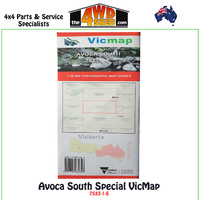
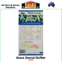
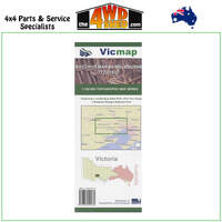
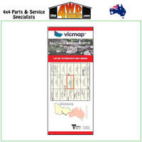
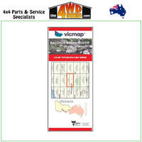
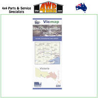
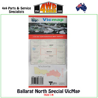
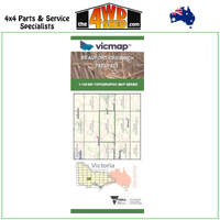
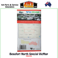
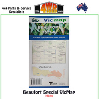
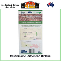
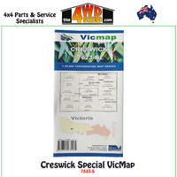
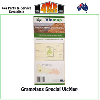
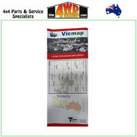
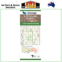
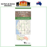
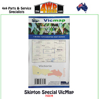
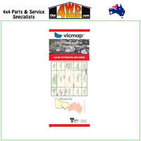
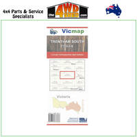
Vicmap
Vicmap data is the authoritative spatial data for the State of Victoria. It is the foundation of Victoria's primary mapping and geographic information systems.
The data can be used for many applications such as: land management, location decisions, marketing, planning, procurement, mapping calls/clients/deliveries and more.