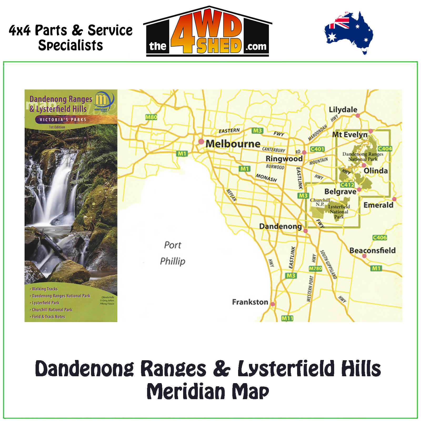
Dandenong Ranges & Lysterfield Hills Meridian Map

 More info
Dandenong Ranges & Lysterfield Hills Meridian Map
Double-sided 1:20,000 scale map of the Dandenong Ranges and Lysterfield Hills. First comprehensive map which covers all the parks in the area including Dandenong Ranges National Park, Churchill National Park and Lysterfield Park. 32 walks are described including the Dandenong Trail and the Dandenong Tourist Track. Shows all tourist sites, local producers, picnic grounds and walking tracks, in and around the parks. Ideal for bushwalkers, day-trippers, mountain bikers and holidaymakers.
Included on this map:-
Mt Everlyn, Kalorama, Montrose,
Sassafras, Monbulk, Olinda, The Basin, Silvan Reservoir, Sherbrooke, Upper Ferntree Gully, Belgrave, The Patch, Menzies Creek, Belgrave Heights, Dandenong Police Paddocks Reserve, Lysterfield South, Lysterfield Lake, Narre Warren North, Dandenong North, Doveton .
- 1:20,000 Scale Maps
- First Edition publishing December 2021
- All new mapping
- Dandenong Ranges Trail
- Dandenong Ranges Tourist Track
- Dandenong Ranges National Park
- Churchill National Park
- Lysterfield Park
- Track notes to 32 walks
- Mountain Bike and other Tourist information
- Map size 600mm(W) x 750mm(H) flat
Please Note: These maps are provided as a guide only. You are responsible for being aware of track closures, changes to track accessibility & access guides. Please visit the Parks Victoria website to check before planning your next journey.
ISBN: 9781920958442
(9781920958442)
| SKU | 9781920958442 |
| Brand | Meridian Maps |
| Shipping Weight | 0.1000kg |


