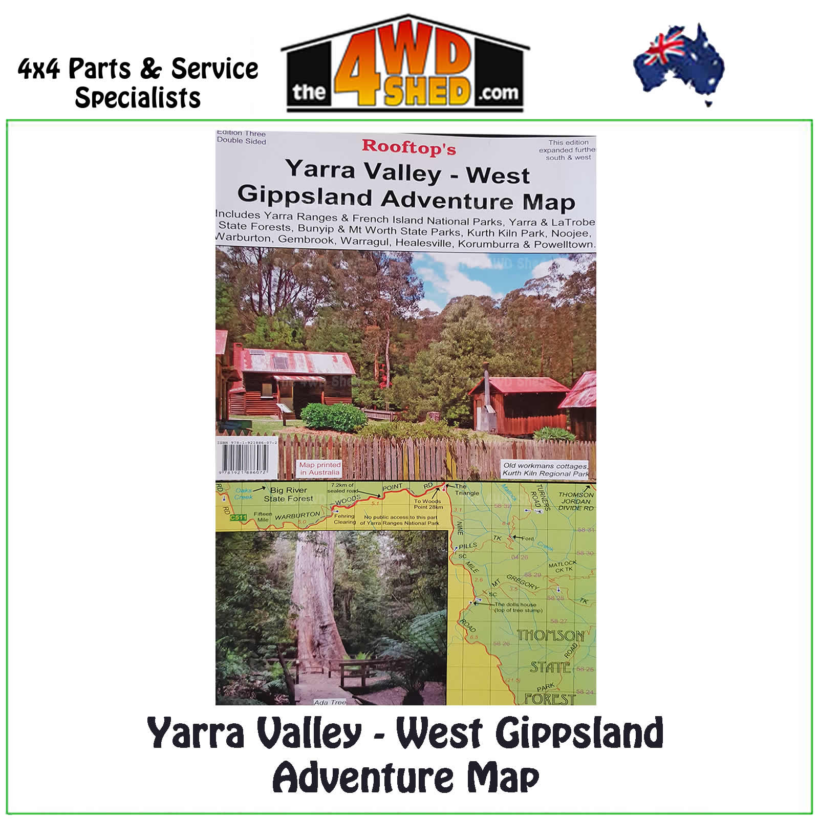


Yarra Valley West Gippsland Adventure Map 1:100 000

 More info
Yarra Valley West Gippsland Adventure Map 1:100 000
Topographical Maps are used for Walking, 4WD, Fishing, Camping, Motorcycle, both On and Off Road, Gold Prospecting and for those simply going for a family weekend drive.
Though moving into an age of GPS & digital maps, paper maps provide a great back up & being more accessible for a group to plot a day out on the tracks.
Map coverage is from Marysville, Narbethong & Cumberland Junction in the north to Mount Worth, Pakenham & Trafalgarin the south. It includes the Yarra Ranges National Park, Bunyip State Park, Yarra State Forest, Gembrook, Kurth Kiln, Noojee, Neerim South, Warragul, Powelltown & Mount Worth State Park.
Map also includes on the reverse a 1:50 000 scale enlargement titled Gembrook - Noojee Forest Activities map with contours. All parks, reserves & state forests are shown & all roads & tracks were plotted using GPS mapping technology.
Scale is 1:100 000 with contours, points of interest, photos etc
- Scale: 1:100 000 map
- Printed both sides
- Suitable for use with GPS
- Extensive 4wd tracks coverage
- Ideal for camping, touring, motorbiking, 4WD & boating
- Walking tracks and campsites
- Colour with contours & notes
Please Note: These maps are provided as a guide only. You are responsible for being aware of track closures, changes to track accessibility & access guides. Please visit the Parks Victoria website to check before planning your next journey.
ISN : 978-1-921886-07-2
(9781921886072)
| SKU | 9781921886072 |
| Barcode # | 9781921886072 |
| Brand | Rooftops |
| Shipping Weight | 0.1000kg |


